It’s been a while since my last post, so I thought I’d share what I’ve been doing and what’s coming up…
Firstly, I’ve been on a bit of a mapping spree. About six weeks ago I finished a map of the Vale of Ukxár…
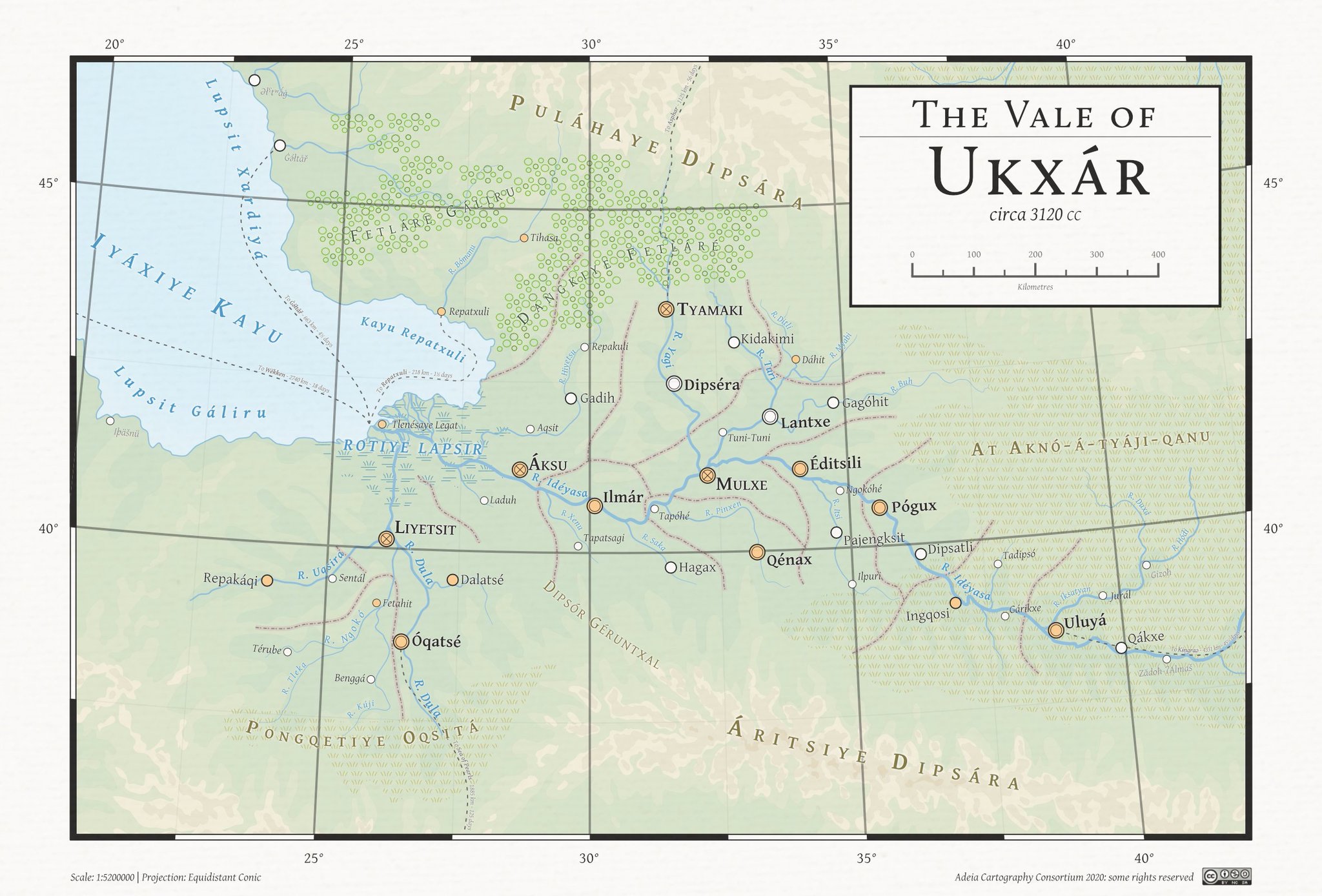
…which I promptly made obsolete a fortnight ago by investigating the phonology of Qári using Praat and discovering that there is no distinction between o and ó, which means I need to relabel the map.
I’ve also been working on a map of Adeia- that is the entire planet. I’m probably about halfway through the process, but what I have so far is (I think) looking pretty good:
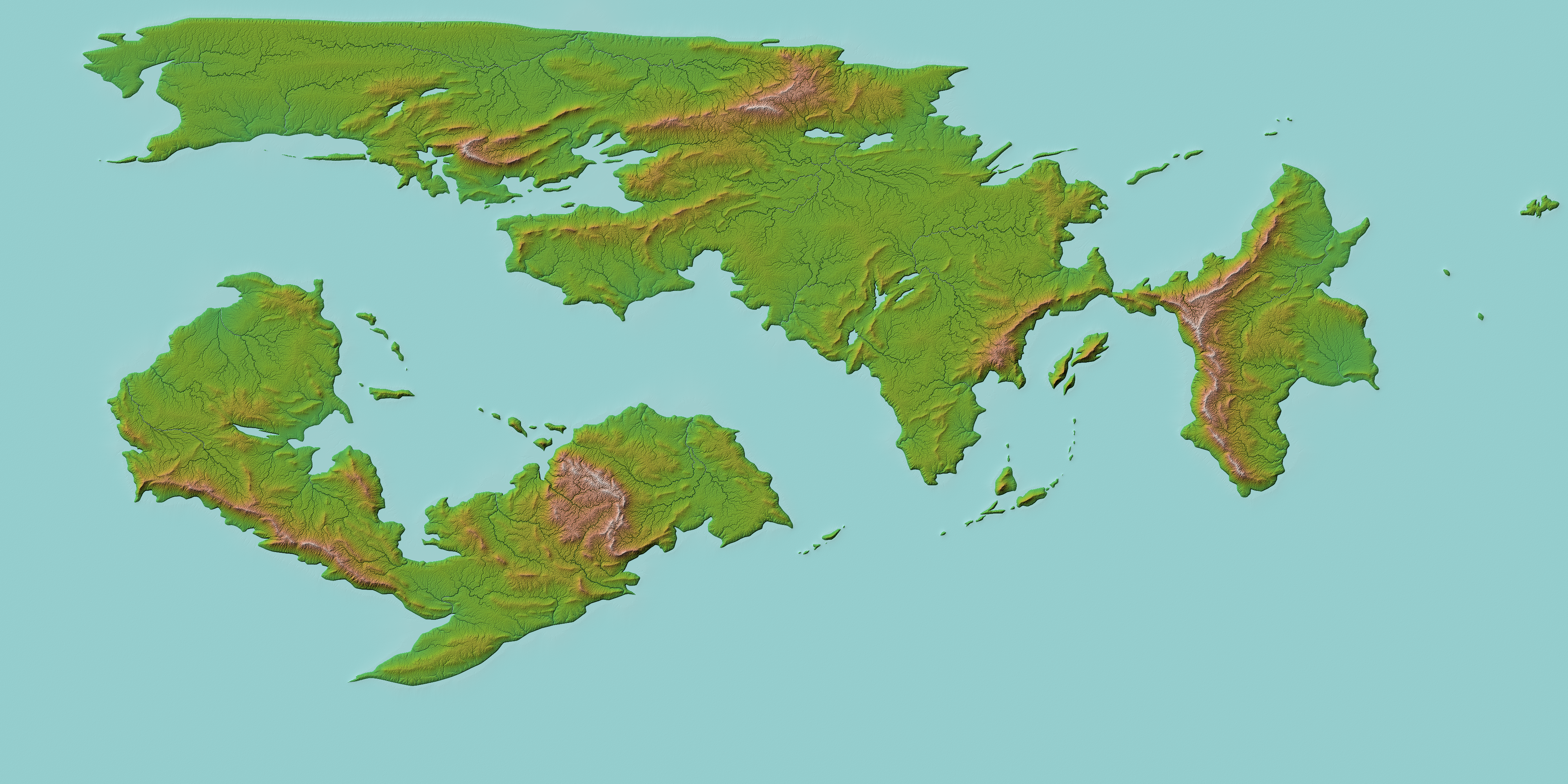
This is just after being processed through Wilbur, an erosion simulator, which takes my heightmaps and makes them look a bit more naturalistic. Still to do is finalise the climate zones and use this to inform the final coastline and the position of the major rivers.
From the point of view of the language, I have two posts in preparation at the moment: one is a write-up of Qári phonology, as mentioned above; and the second is a treatment of mood and modality in Qári, as I’ve finally figured out conditional constructions (inter alia) to my satisfaction.
Slightly more long term, I’ve been planning for three lengthy culture posts: one a geographical “tour” of Ukxár to accompany the map; two a description of trance and its relation to Qári religiosity and conceptions of mental health (more interesting than I make it sound, I promise!); and three the biggie- a concise-ish history of the Vale of Ukxár from the beginnings of agriculture c. -5000, to the final collapse of the Qári civilisation and the end of the Bronze Age c. 3000.
While planning for the last, I’ve actually outlined a post on early agricultural terminology in Qári: since discovering that the Qáritu are not autochthonous to Ukxár, I’ve also realised that the bulk of agricultural terminology is borrowed from a substratum. As such things are wont to do in conlanging and worldbuilding, this has gotten out of hand and as such I’ve sketched a throwaway language to serve as said substratum. That post will probably see the light of day first.
As ever, thank you for your interest in my ongoing obsessions!
Nice maps! How did you create the Adeia one, before feeding it to Wilbur? As a vector image, same as the Vale one? Or was it created with software such as Fractal Terrains? If so, how difficult was it to map the Vale picture (that I guess came first) to the global map?
Nice maps! How did you create the Adeia one, before feeding it to Wilbur? As a vector image, same as the Vale one? Or was it created with software such as Fractal Terrains? If so, how difficult was it to map the Vale picture (that I guess came first) to the global map?